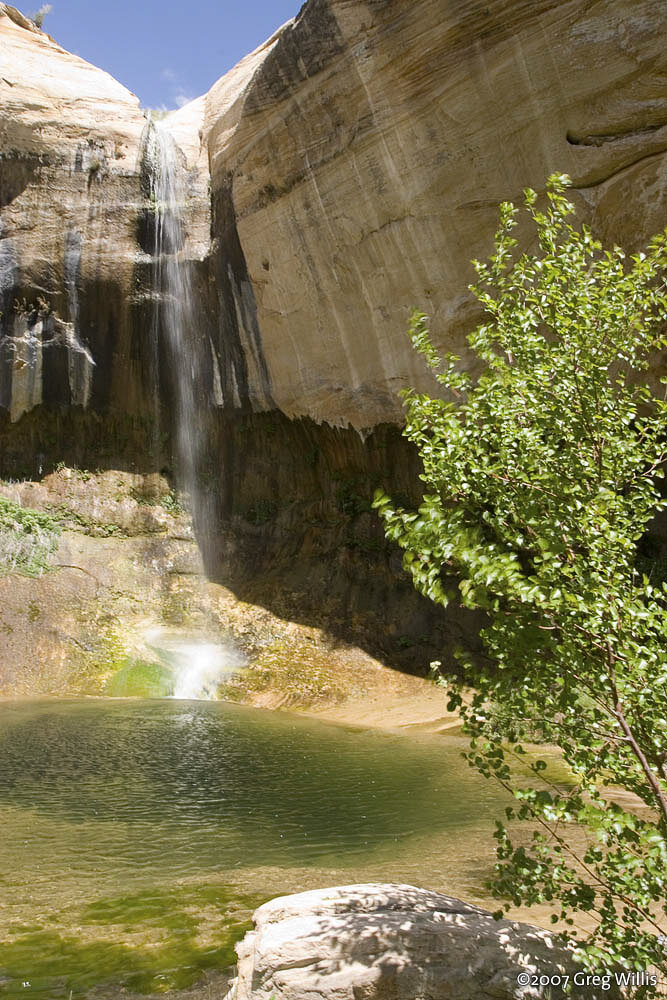
A 126-foot desert waterfall and plunge pool reached by a 6-mile round-trip hike through a sandstone canyon in Grand Staircase-Escalante.
Lower Calf Creek Falls drops about 126 feet into a pool at the end of a roughly 6-mile round-trip hike along Calf Creek, inside Grand Staircase-Escalante National Monument. The trail is sandy with minimal elevation change but can be strenuous in summer heat, following the creek past Fremont-era granaries and pictograph panels roughly a mile and a half up the canyon.
The trailhead is managed by the Bureau of Land Management at the Calf Creek Recreation Area on Utah State Highway 12, between Escalante and Boulder. Carry far more water than feels necessary — shade is limited and the sand underfoot makes the walk slower than the distance suggests. A separate, much harder scramble reaches Upper Calf Creek Falls from a different trailhead; the two are not connected by an easy route.
Know before you go
Calf Creek Recreation Area, Utah State Highway 12, between Escalante and Boulder, UT.
Spring and fall are most comfortable; summer heat is a real hazard.
About 6 miles round trip, sandy and flat but can be strenuous in heat.
Day-use fee at the BLM trailhead; check current rates.
Not accessible; long sandy desert-canyon trail.
2026-10-11. Conditions and requirements can change; confirm with the land manager before travelling.
Sources & further reading
- Bureau of Land Management — Lower Calf Creek Falls Trail ↗
- USGS Geographic Names Information System (GNIS) ↗
This is a researched visitor guide, not a claim that our editors have personally visited. Trail conditions, permits, and access can change.